LEO-2
Powerful And Reliable

Centimeter-Level
Positioning

Redundancy System

20KM
Datalink

Vibration
Isolation

Temperature
-40~75℃

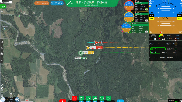
GCS Controls
Multiple Platform

Centimeter-level Precise Positioning
- Supports GPS(L1/L2)、GLONASS(L1/L2)、Galileo*、BDS(B1/B2);
- Positioning accuracy 1cm+1ppm;
- Work with RTK and PPK simultaneously;
- Dual antenna orientation, orientation accuracy can reach 0.2 °;
- Dual redundancy satellite receiver;
- The maximum sustainable storage of PPK data is 208 hours;
20 KM-DATALINK
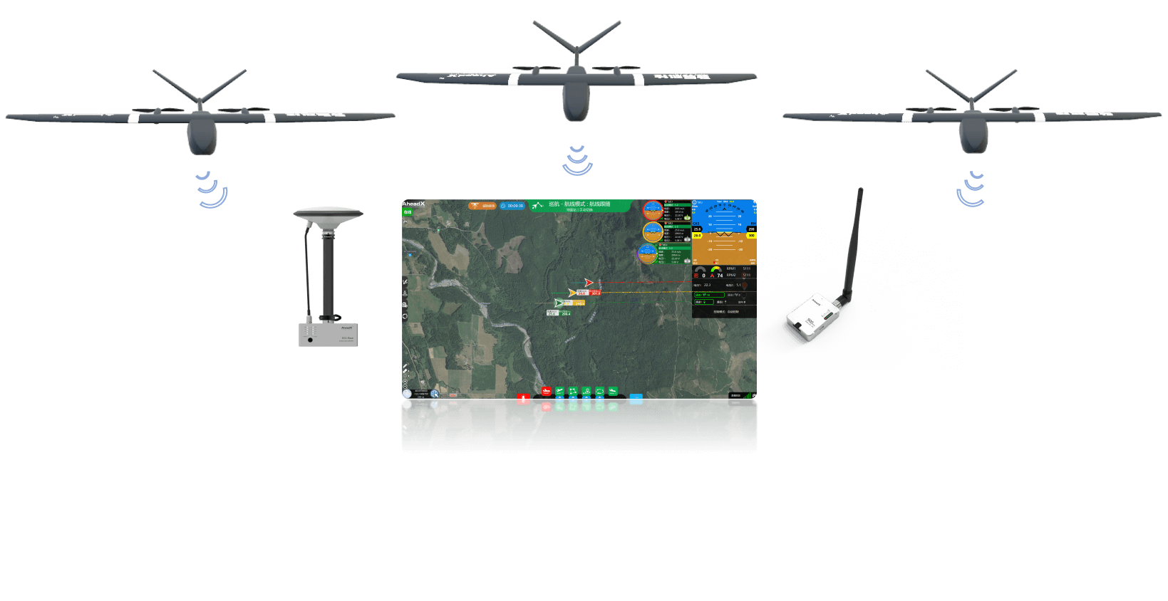
Leo 2 standard 20 KM data link to meet the needs of general scenarios. Supports flight
formation and one GCS controls multiple platform


- In extreme cold environment (minimum -40 ℃), the temperature control system will automatically preheat to keep the flight control at the best working temperature.
- In extremely hot environment (up to 75 ℃), the internal temperature is quickly derived through the graphite mixed heat dissipation technology to ensure stable flight control operation.
- Power supply isolation, 12 V ~ 53 V isolated power supply , multiple protection mechanisms for undervoltage, short circuit and overcurrent, reaching EN62368 (World Product Safety Standard) certification standard;
- The signal isolation of the actuators completely solves the reliability problems such as signal interference caused by complex ground loops.
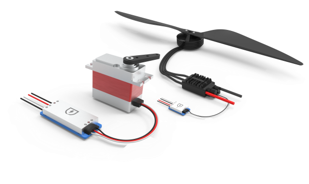
- Isolation module S for supply and signal/E for ESC signal
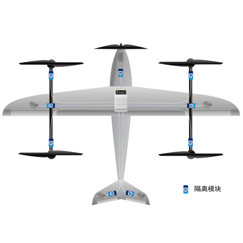
- The signals are individually isolated to ensure the electrical reliability of the entire system
It supports up to 208 hours of airborne flight data / post-differential data / POS data, which can be directly exported to Leo 2 using a USB Type-C data cable.
![]() 10 HZ Log, clearly record flight operations!
10 HZ Log, clearly record flight operations!![]() PPK data, high-precision job data output!
PPK data, high-precision job data output!![]() Camera POS data, quickly export!
Camera POS data, quickly export!


Dual Redundant DataLink

3 Redundant Heading
Measuring Within Accuracy of 0.2 deg

Dual redundant Satellite receiver
Positioning accuracy within 1 cm

Dual Processor
Processing capacity up to 1440 DMIPS

4 Redundant IMU
Attitude accuracy within 0.05°

3 redundant airspeed measurement
-40~75℃ Compensation
The powerful computing power of Leo 2 is equipped with the leading advanced real-time motion planning algorithm AxPlanner, which can ensure that the drone can complete the transition between the flight segments in the most energy-saving and dynamic reachable way, and ensure that it enters the measurement area with a stable attitude. Improve the effect of taking pictures.
It solves the problem of adding a large number of transition points and assisting turning points in task planning such as surveying and inspection

left:normal, right:Axplanner (WS 8m/s)

left:normal, right:Axplanner (WS 10m/s)
LEO-2 supports the terrain following to adapt to areas with large terrain fluctuations.
- Adapt to the flight performance of the drone to ensure flight safety;
- Automatic terrain sampling, automatically improve the sampling accuracy in areas with large terrain fluctuations; reduce the sampling frequency in areas with small terrain fluctuations to prevent frequent attitude adjustment of the aircraft。
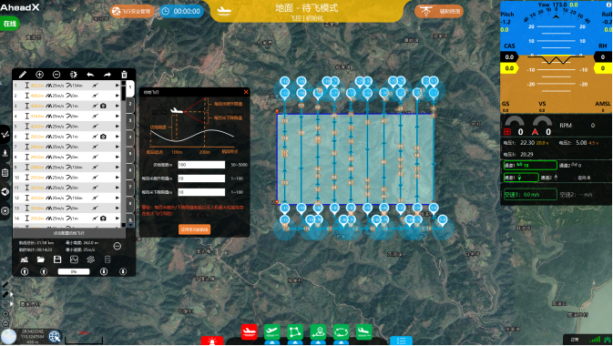
Terrain Following Planning
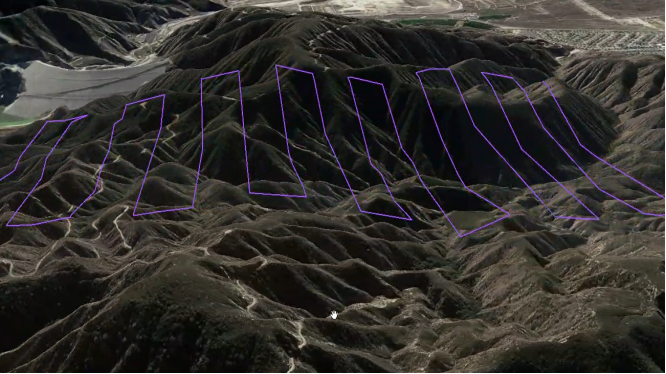
Terrain Following Check
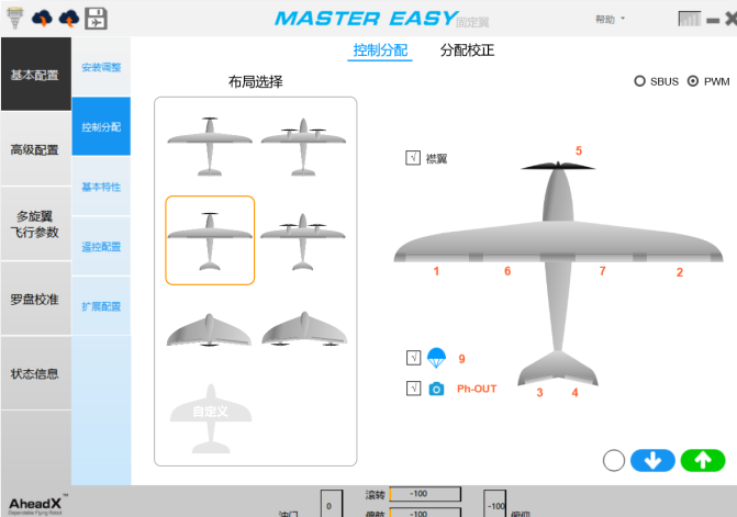
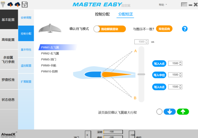
Master Easy Software
Remove tedious parameter adjustments and introduce a lot of graphical interactions, this is how it looks, Installation debugging and flight debugging will no longer be a problem, and novices can learn quickly.
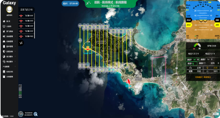
AheadX System Software
Enjoy the efficient flight experience brought by AheadX's latest technology upgrade You can use the functions of cloud management, remote control, RTK base station sharing, network RTK, and no-fly query for drones in the Galaxy system Space V3 Pro one GCS controls multiple platform, achieving large-scale UAV surveying and flight formation.
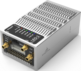

- Positioning width centimeter-level
- 20KM DataLink
- Easy to plug, quick installation
Size:107*57*40mm
Weight:286g
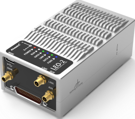

- Positioning width centimeter-level
- 20KM DataLink
- J30J interface
Size:107*57*40mm
Weight:284g
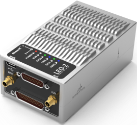

- Positioning width centimeter-level
- Adapt to pods and obstacle avoidance sensors
- PWM * 19; Serial port * 6; V monitoring * 5
- J30J interface
Size:107*57*40mm
Weight:286g